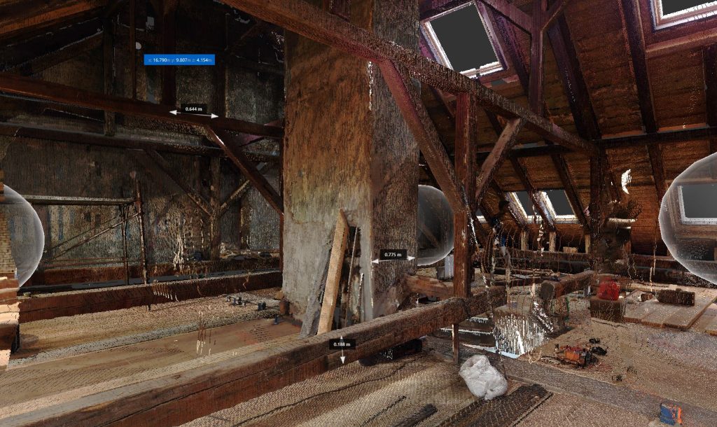
As-Built 3D Laser Scanning
Ideal for capturing existing as-built structures, renovations, reconstructions, monitoring construction sites, and preserving architectural heritage.
High Precision
Millimeter-level accuracy at distances up to 40 m, and a maximum scanning range of 100 m.
Fast Site Capture
Buildings of 2,000–3,000 m² can be scanned within a single working day, without interrupting activities on-site or inside the building.
One Site Visit – Complete, Permanent Data
No more returns for missed measurements. Scanning provides a full, permanent point cloud model of existing conditions.
Everything Visible in the Point Cloud
Every detail can be measured, analyzed, or reconstructed directly from the point cloud.
360° Photospheres
Visual documentation integrated with the point cloud – making navigation and team communication easier.
Time Savings and Less Errors
Faster decision-making and construction planning, all based on one accurate source of data.
Construction Site Monitoring
Scanning of completed structures and finish work. Capture of installations before walls/floors are finalized for accurate documentation of “hidden” systems.
ADDITIONAL SERVICES
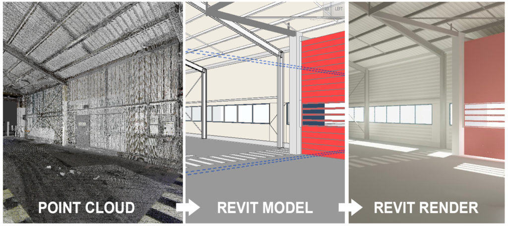
Modeling from Point Clouds
We deliver Revit or CAD models based on scanned data. Different format types available on demand.
Training in Point Cloud Use
We train your team to work efficiently with point cloud models – within your software tools of choice.